
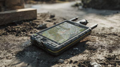
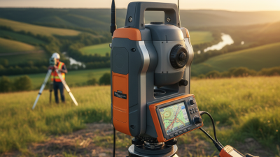
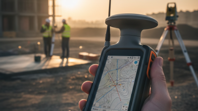
When it comes to precision surveying, choosing the right tools is kind of a big deal. The Gnss Dgps Survey Instrument is a key player that really helps improve the accuracy of location data you gather during different surveying projects. Whether you're working on a construction site, doing land surveys, or checking out environmental conditions, picking the right instrument can be the difference between getting super precise results or ending up with costly mistakes.
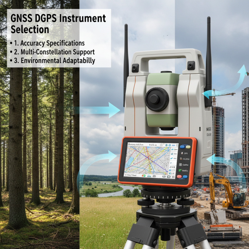
Now, if you're looking at GNSS DGPS Survey Instruments, there are a few things you'll want to keep in mind—like how accurate they are, how reliable, easy to use, and whether they play nice with your existing systems. It’s all about understanding what your project needs so you can make a smart choice. This guide’s here to help you navigate through all those options out there, highlighting what really matters when choosing a GNSS DGPS Survey Instrument. By staying up-to-date with the latest tech and features, surveyors can choose the best tools for their projects and set themselves up for success.
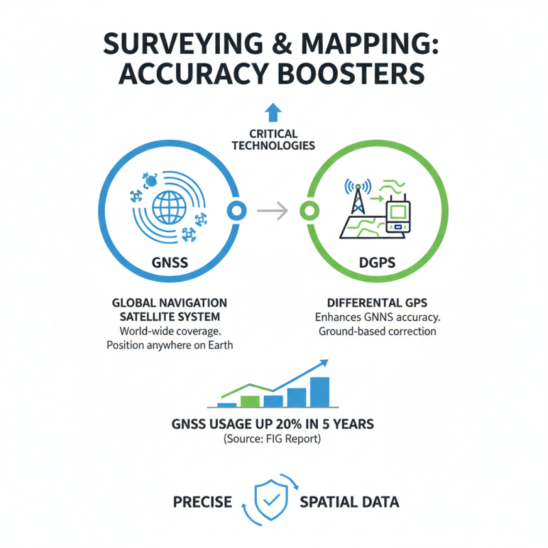
Global Navigation Satellite System (GNSS) and Differential Global Positioning System (DGPS) are critical technologies that enhance the accuracy of GPS measurements, making them essential tools in surveying and mapping disciplines. GNSS, which comprises a constellation of satellites providing geospatial data, enables users to pinpoint locations anywhere on Earth. According to a report by the International Federation of Surveyors, the use of GNSS has increased by 20% in the last five years across various industries, highlighting its growing importance in delivering precise spatial data.
DGPS takes GNSS a step further by correcting the signal errors caused by atmospheric conditions, satellite drift, and other factors. By utilizing ground reference stations to provide real-time corrections, DGPS can improve positioning accuracy from 5-10 meters (typical for GNSS) to within 1 meter. In industries such as agriculture, construction, and geodesy, this level of precision is invaluable. The American Society for Photogrammetry and Remote Sensing indicates that accurate DGPS measurements can lead to cost reductions of up to 15% on project budgets, emphasizing the need for effective instrument selection to achieve optimal results in field applications.
Accurate measurements in surveying are paramount, as they directly influence the quality of the data collected and the decisions made based on that data. According to the National Oceanic and Atmospheric Administration (NOAA), even a small error in measurement can lead to significant discrepancies in project outcomes, potentially costing millions in time and resources. The precision of GNSS DGPS instruments is critical in this regard, ensuring that the data collected is reliable and reflective of actual conditions on the ground.
Furthermore, a report by the International Federation of Surveyors indicates that high-accuracy measurements, within a margin of error of less than 5 centimeters, can enhance the effectiveness of various applications including construction, urban planning, and environmental monitoring.
In environments where land tenure and resource management are in question, the role of accurate surveying goes beyond mere technical precision; it also underpins robust legal frameworks and sustainable practices. Thus, investing in the right GNSS DGPS survey instrument significantly contributes to achieving these high standards of accuracy, which are essential for making informed decisions in any surveying project.
When selecting a GNSS DGPS survey instrument, several key factors should be carefully evaluated to ensure accurate measurements. First, it's essential to consider the receiver's accuracy specifications. Instruments vary in their ability to provide precise location data, so looking for equipment that offers high positional accuracy within the specific types of environments you will be working in is crucial. Additionally, consider the type of signals the instrument can process, as some models support multiple GNSS constellations such as GPS, GLONASS, Galileo, and BeiDou, enhancing reliability and accuracy.
Another important factor is the instrument's ease of use and ergonomics. Survey instruments should be user-friendly, allowing operators to efficiently navigate settings and data collection processes, especially in the field. The interface and software compatibility also play a significant role in workflow efficiency, making it easier to analyze and interpret the collected data. Lastly, assess the instrument's durability and battery life, as these features significantly impact performance, especially in remote or rugged surveying environments where access to power sources may be limited. Taking these factors into account will lead to more precise and reliable surveying results.
When selecting a GNSS DGPS survey instrument for precise measurements, understanding the array of technologies available is crucial. Global Navigation Satellite System (GNSS) combined with Differential Global Positioning System (DGPS) provides enhanced accuracy over standard GPS by correcting signal errors, making it ideal for surveying applications. Different technologies deliver various benefits, including improved accuracy, reliability, and operational flexibility.
Firstly, consider the type of augmentation used, such as ground-based stations or satellite-based augmentation systems (SBAS). Ground stations offer real-time corrections, which can significantly enhance the precision of measurements in localized areas.
Secondly, assess the frequency of the GNSS signals being utilized. Dual-frequency receivers can mitigate atmospheric interference more effectively than single-frequency systems, providing more accurate positioning data. Additionally, technologies like Real-Time Kinematic (RTK) positioning and Post-Processing Kinematic (PPK) methods boast high precision levels, essential for surveying tasks that require centimeter-level accuracy. The choice between these methods depends on the specific surveying requirements, including the environment and desired accuracy.
Ultimately, comparing these technologies will help identify the most suitable GNSS DGPS instrument, ensuring consistent and reliable data collection in various surveying scenarios.
When evaluating performance metrics for DGPS survey instruments, it is crucial to consider factors that directly affect measurement accuracy and reliability. One of the primary metrics is the horizontal and vertical accuracy specified by the manufacturer. This accuracy is often influenced by the system's ability to minimize errors, whether stemming from satellite signal delays, multipath effects, or other environmental factors. Instruments should also be evaluated based on their real-time performance; a system that provides rapid updates and corrections significantly enhances data reliability in dynamic survey conditions.
Another important aspect is the tool's positional dilution of precision (PDOP), which indicates the quality of the satellite configuration. A lower PDOP value generally signifies better satellite geometry and, therefore, more reliable measurements. Additionally, the receiver's ability to track multiple frequencies can improve performance, particularly in challenging environments where signals may be obstructed. The integration of advanced augmentation techniques can also be a vital metric to assess, as these features can enhance the accuracy and integrity of the data collected, making it essential for users to analyze these specifications when selecting the best DGPS survey instrument for their specific needs.
| Instrument Model | Accuracy (m) | Robustness (Rating) | User Interface (Rating) | Battery Life (hours) | Price (USD) |
|---|---|---|---|---|---|
| Model A | 0.02 | 4.5 | 4.0 | 24 | 1500 |
| Model B | 0.03 | 4.0 | 4.5 | 20 | 1200 |
| Model C | 0.01 | 5.0 | 4.8 | 30 | 2000 |
| Model D | 0.04 | 3.5 | 3.8 | 15 | 900 |
When budgeting for GNSS Dgps Survey Equipment, it is essential to consider both the initial investment and the long-term costs associated with maintenance and updates. According to a 2021 market analysis report by the Geospatial Industry Foundation, organizations should anticipate spending between $5,000 to $15,000 for basic GNSS DGPS units, with advanced models reaching upwards of $30,000. It’s crucial to evaluate the specs needed for your specific applications, as precise measurements can dramatically affect project outcomes and efficiency.
Tips: Prioritize your project's requirements when selecting equipment. Assess factors like accuracy levels, the durability of the instrument, and compatibility with existing hardware. Additionally, don’t underestimate the potential savings associated with higher-quality instruments; a better initial purchase can lead to reduced operational costs over time due to less frequent maintenance needs.
When planning your budget, remember to factor in software and training expenses. Comprehensive software solutions can enhance data processing capabilities, often costing between $1,000 to $5,000. Professional training is equally vital and can range from $500 to $2,000, depending on the complexity of the equipment. Investing in these aspects ensures that your team can effectively utilize the GNSS DGPS technology, further optimizing measurement accuracy and reducing errors in the field.
Maintaining and calibrating your GNSS DGPS instruments is essential to ensure accurate measurements in your surveying tasks. Regular maintenance checks help identify any wear or damage to components that could affect performance. Keeping the hardware clean, particularly antennas, is crucial as dirt and debris can obstruct satellite signals, leading to inaccuracies. Furthermore, checking for software updates and applying them promptly will enhance the functionality and reliability of the instruments.
Calibration is another critical aspect that should not be overlooked. Instruments should be calibrated periodically according to the manufacturer’s guidelines or industry standards. This process typically involves comparing measurements from your instrument to a known reference point to identify any discrepancies. If any calibration errors are found, adjustments must be made to restore precision. Consistent calibration not only extends the lifespan of the equipment but also ensures that measurements remain within the required accuracy thresholds, ultimately improving the quality of your surveying outcomes.
This chart illustrates the accuracy measurement results of various GNSS DGPS survey instruments after regular maintenance and calibration. The data displayed includes the average position error in centimeters (cm) for each instrument type.
: Global Navigation Satellite System (GNSS) is a system of satellites providing geospatial data that allows users to pinpoint locations anywhere on Earth. Its importance lies in delivering precise spatial data, which is increasingly utilized across various industries.
Differential Global Positioning System (DGPS) improves accuracy by correcting signal errors caused by atmospheric conditions, satellite drift, and other factors through real-time corrections from ground reference stations, enhancing positioning accuracy from 5-10 meters to within 1 meter.
DGPS offers enhanced precision, which is invaluable in industries like agriculture, construction, and geodesy, potentially leading to cost reductions of up to 15% on project budgets due to more accurate measurements.
One should consider the type of augmentation (ground-based or satellite-based), the frequency of GNSS signals (dual-frequency vs. single-frequency), and high-precision technologies like Real-Time Kinematic (RTK) and Post-Processing Kinematic (PPK) methods based on specific surveying needs.
Regular maintenance checks are essential for identifying wear or damage. Keeping hardware clean, especially antennas, ensuring timely software updates, and following manufacturer guidelines for calibration are critical for maintaining the instruments.
Calibration is essential to ensure measurements are accurate. It involves comparing instrument readings to a known reference point, identifying discrepancies, and making necessary adjustments to restore precision, ultimately enhancing the quality of surveying outcomes.
Atmospheric conditions can cause signal errors that affect the accuracy of GNSS measurements, which is why methods like DGPS are vital to correct these errors in real-time.
Signal augmentation refers to methods used to enhance the accuracy of GNSS data, such as using ground reference stations for real-time corrections or employing satellite-based augmentation systems (SBAS) to improve reliability.
Instruments should be calibrated periodically according to manufacturer guidelines or industry standards to ensure ongoing accuracy and reliability in measurements.
Different technologies offer varying benefits, including improved accuracy and reliability, allowing users to select systems that best fit their specific operational needs and surveying environments.
When selecting a GNSS DGPS survey instrument for accurate measurements, it is crucial to understand the foundational concepts of GNSS and DGPS. Accurate measurements play a vital role in surveying, influencing project quality and outcomes. Key factors to consider include the type of GNSS technology, performance metrics of different instruments, and the budget allocated for the equipment.
Additionally, it is important to regularly maintain and calibrate your GNSS DGPS instruments to ensure optimal performance over time. By comparing various available technologies and evaluating their capabilities, surveyors can make informed decisions that lead to precise and reliable measurement results. Ultimately, choosing the right GNSS DGPS survey instrument is essential for achieving excellence in surveying projects.
